Kiyosato 清里町
きよさとちょう
Kiyosato is a farming town of wheat, sugar beet and potato fields below Mt. Shari (斜里岳). It has the cobalt-blue spring pond Kaminoko-ike (神の子池), and since 1979 it has made what the town calls Japan's first potato shochu, in a distillery the town owns.
- Population (2020 Census)
- 3,883
- Area
- 402.76 km²
- District
- Shari District (斜里郡)
- Official website
- www.town.kiyosato.hokkaido.jp
Known for
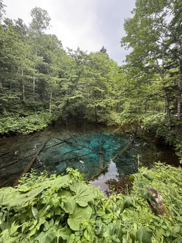
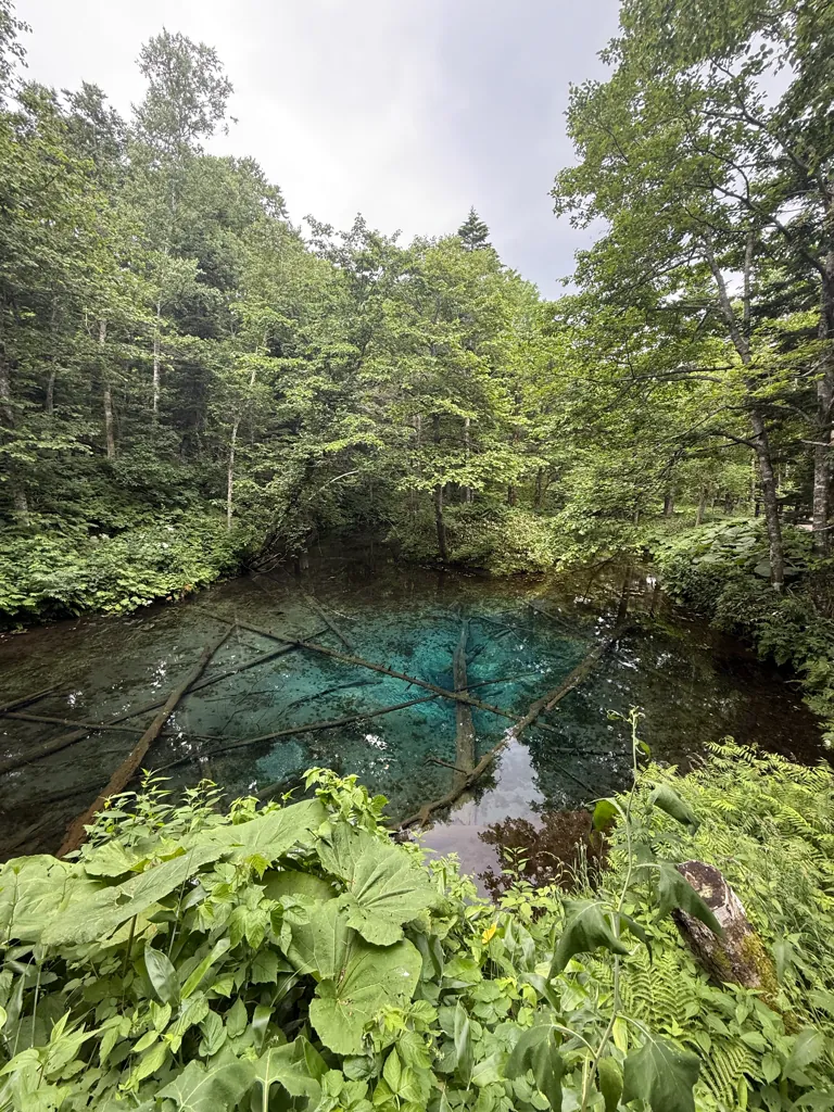
- Kaminoko Pond (神の子池): a spring pond 220 m around and 5 m deep. About 12,000 t of water a day wells up here, at 8 °C all year. Dolly Varden trout (オショロコマ) live in it10. It had 59,272 visitors in 2024, more than any other sight in town6.
- Potato shochu (じゃがいも焼酎): the town-owned distillery released "Kiyosato", which it calls Japan's first potato shochu, in 197911. The brand is now sold as "Hokkaido Kiyosato" (北海道 清里), and the town marked the shochu's 50th anniversary in 2025, counting from the start of the brewing project in 19756.
- Mt. Shari (斜里岳, 1,547 m): one of the 100 Famous Mountains of Japan (日本百名山), and the shape on the town emblem129.
- Ura-Mashu Observatory (裏摩周展望台): a view of Lake Mashu from the "back" side. At 585 m it sits lower than the viewpoints on the Teshikaga side (683 m and 701 m), so it is less often in fog13.
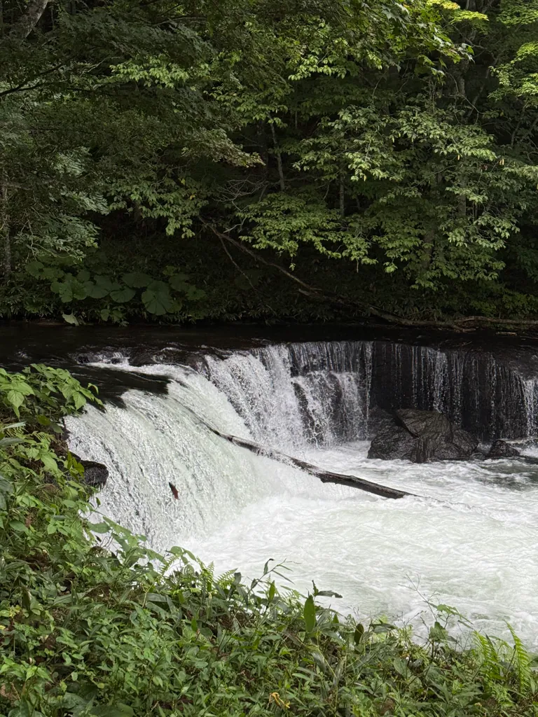
- Sakura Falls (さくらの滝): a 3 m fall on the Shari River. About 3,000 cherry salmon (サクラマス) come back each year, and they try to leap it from early June to late August14.
- Large-scale upland farming: 8,980 ha of fields and no rice paddies15. Windbreak lines split the fields into geometric blocks. The Most Beautiful Villages in Japan association (日本で最も美しい村), which Kiyosato joined in 2016, lists this landscape among the town's assets167.
- A very clean river: the town's statistics book says that in the Ministry of the Environment's FY2003 water-quality results, the upper and middle Shari River were rated the cleanest rivers in Japan6. The ministry's own ranking was not checked here.
Sights & activities
Nature & scenery
- Kaminoko Pond (神の子池).
- Access: 25 km from the town center on the Mashūko–Shari road (道道摩周湖斜里線) toward Nakashibetsu, then about 2 km on the Hatoi forest road. Map code 910 216 16110.
- Road: the forest road is closed to large and medium vehicles, its edges crumble, and mobile signal is weak10. It is snowed in until late May, so in winter and spring you walk 4 km there and back from the main road36.
- Why so blue: the water is very clear, the pond is just deep enough, and the bottom is white volcanic ash. Water tests suggest the spring is rain and snow from the Mashu outer rim, not Lake Mashu itself36.
- A wooden boardwalk was built around the pond in October 2015 to protect it from people stepping in, litter and silt36.
- Ura-Mashu Observatory (裏摩周展望台).
- Access: 37 km from town toward Nakashibetsu, on the town's border with Nakashibetsu. In 2026 the gate is open from 9:00 on 20 April to 9:00 on 30 October, and snow can linger past May13.
- Facilities: free parking for 15 cars and a summer rest house with a shop. The Ministry of the Environment built a new stepped wooden viewing deck, completed on 19 July 202113.
- View: the lake, its shoreline forest and Kamuinupuri (摩周岳)13.
- Sakura Falls (さくらの滝).
- Access: about 7 km from Sattsuru. Take the Mashūko–Shari road 5 km toward Midori, turn left, go straight 700 m, turn right and follow the road 1.7 km. Map code 444 228 43014.
- Name: chosen in a public contest in 200214.
- Cautions: the ground in front of the viewing area is failing and has been roped off. Fishing is banned all year, and bears are sometimes seen14.
- Ojika Falls (男鹿の滝). A 25 m fall with no river above it. About 30,000 t a day of spring water from Mt. Shari pours straight out of the rock. It is 36 km from town and about 20 km from Midori, at the Go-no-sawa branch of the upper Shari River. Drive 4 km past Midori toward Nakashibetsu and turn left onto the Shari River forest road. After 7 km, carry straight on where it becomes gravel, and go about 9 km more to a parking area, then walk a few minutes. Bears are a risk and mobile signal is poor37.
- Space Observatory (宇宙展望台). A 13 m tower6 between the auto campground and the Kōnan park-golf course38. By day it looks over the farmland, and at night it is a place for stargazing. The road is not plowed in winter38.
- Hoshikaze-no-Oka (ほしかぜの丘). A hill on the old Kōnan ranch with views of Mt. Shari, the Shiretoko range and the Sea of Okhotsk6.
- Farm landscape. Potato flowers and waving wheat in summer, busy harvests in autumn39. The "Straight Road" (ストレートロード) runs in a straight line for 14 km toward the Sea of Okhotsk40. Do not walk into fields: boots can carry germs and pests onto crops. Drone flights at tourist sites are banned in principle, unless they have aviation-authority permission and the landowner's consent41.
Onsen
- Kiyosato Onsen Hotel Ryokuseisō (きよさと温泉 ホテル緑清荘), Hagoromo-chō 31.
- Midori no Yu (緑の湯), Midori-chō 26, a 3-minute walk from JR Midori Station.
- Papas Land Sattsuru: see Roadside stations below.
Museums & heritage
- Kiyosato Shochu Distillery (清里焼酎醸造所), Hagoromo-chō 62.
- Kiyoru (きよ~る), next to the distillery. It has tourist and relocation information, shochu tasting, local products and a café.
- In 2026 it is open 9:00–18:00 from 20 April to 25 September and 9:00–17:00 the rest of the year. Closed over New Year28.
Outdoor & seasonal activities
- Climbing Mt. Shari.
- Trailhead: Seigakusō (清岳荘, Kōnan 872), about 15 km from town. Drive about 5 km south, then east on Minami 23-gō, then about 8 km on a forest road. In 2026 the road and hut were open from 12 June to 30 October124546.
- Routes: about 4 hours up and 3.5 down. Most people climb the stream route past three waterfalls (Hagoromo, Miharashi and Ryūjin) and come down the ridge route46.
- Seigakusō: sleeps 50, ¥1,570 per adult per night, plus ¥100 Hokkaido accommodation tax. It has parking for about 45 cars. The tap water is not drinkable. Book through the tourism association (0152-25-4111)45.
- Rules: sign the register, carry a bell or whistle for bears, start early and take all rubbish home4712.
- Kiyosato Auto Campground (清里オートキャンプ場), Kōnan 807.
- 2026 season: from 1 June48.
- Sites: 5 cottages (¥14,000), 7 bungalows (¥5,000), 20 car sites and 5 pet sites (¥2,000 each), and 23 free tent sites (¥1,000), all per night. On top of this there is an entry fee of ¥500 for adults (junior-high age and up) and ¥300 for children; day visitors pay only the entry fee48.
- Also: coin showers and a coin laundry48.
- Kōnan Park Golf Course has 6 courses and 54 holes. The Ura-Mashu outer rim and Kaminoko Pond trail is part of the Hokkaido East Trail (北海道東トレイル)6.
- Guided tours. The tourism association can arrange mountain guides, cycling routes, a "Hatake de Guide" (畑 de ガイド) farm tour, and winter snowshoe or ski-shoe tours to Kaminoko Pond49.
Food experiences
- At Papas Land, the restaurant "Papas" serves tonkatsu and Chinese dishes50.
- In town, the sushi bar 毘和吉 makes sushi every day, and 炉憩 cooks creative dishes with local produce. Shokuji Fuji (食事富士) serves ginger-pork sets and butadon. Odashi Shokudō (おだし食堂) makes soup curry with local vegetables. Marufu Coffee (マルフ珈琲) in Midori serves specialty coffee in a log house31.
Roadside stations (Michi-no-Eki)
Papas Land Sattsuru (道の駅パパスランドさっつる)
- Location: Kamui 1071-4, Kiyosato, on the Mashūko–Shari road (道道摩周湖斜里線). Tel. 0152-26-228851. Distances: Sakura Falls about 8 km, the distillery about 7 km, Kaminoko Pond about 20 km, Ura-Mashu Observatory about 28 km50.
- Hours: Building 9:00–21:00, shop 9:00–17:00, restaurant 11:00–16:00 (last order 15:30), hot spring 11:00–21:00. Open every day except New Year; the town says "year-end and New Year"51, while the Michi-no-Eki site lists only 1–2 January as closed days50. As of September 2026 — check before visiting.
- Shops & products: A farm stand sells fresh local vegetables every day5051. The tourism association lists the Michi-no-Eki among places that sell potato shochu and Sawada Farm's tofu and miso27.
- Food: Restaurant "Papas" (レストラン「パパス」) serves tonkatsu and Chinese food. Its new favorite is a limited rib-roast katsu set (リブロースかつ定食)50. JA Kiyosato lists the restaurant among those serving its "Kiyosato Kirimugi" wheat noodles23, and says its "Kiyosato tsukemen" (清里つけめん) was created with the Michi-no-Eki30. Soft-serve or other desserts are not listed on the official pages (unverified).
- Facilities:
- Parking: 95 cars and 5 large vehicles50.
- Toilets: warm-water bidet seats (温水洗浄便座), an accessible toilet and ostomate facilities; the ostomate facility is not available 24 hours. The official site does not list 24-hour toilets or EV charging50.
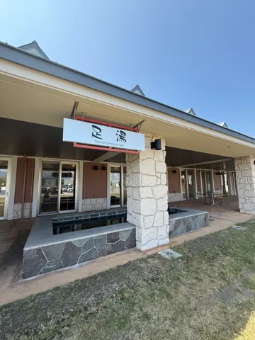
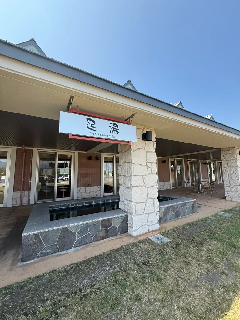
- Hot spring: free-flowing natural water, with an open-air bath, utase-yu (a hot waterfall shower) and a free footbath. ¥480 for ages 12 and up, ¥150 for children, free for preschoolers (prices from 1 April 2025)51.
- Free 18-hole park-golf course (late April–October)51.
- Community activity rooms for food processing, pottery and crafts. They open Wednesday–Saturday and must be booked at the Michi-no-Eki desk at least 7 days ahead51.
- Wi-Fi, information desk, dog run, credit cards and other cashless payment50.
- A gas station is 1 minute away by car but closed on Sundays50.
- Notes:
- Registered on 10 August 2007 as Hokkaido Michi-no-Eki No. 101. Stamps can be pressed during opening hours506.
- The Papas Land building first opened in 1991 and was rebuilt in 2012–136.
- Other Michi-no-Eki nearby: Shari (道の駅しゃり) and Utoro Shiriettoko (道の駅うとろ・シリエトク) in Shari, Hanayaka Koshimizu (道の駅はなやか(葉菜野花)小清水) in Koshimizu, and Mashū Onsen (道の駅摩周温泉) in Teshikaga52.
Getting there & around
- Rail:
- The JR Senmō Main Line (釧網本線) has three stations in town: Kiyosatochō (清里町), Sattsuru (札弦) and Midori (緑)8. Kiyosatochō is 49.2 km down the line from Abashiri. Minami-Shari Station, between Shari and Kiyosato, closed in 2021, and since 2024 every train on the line has been an H100 railcar53.
- The statistics book lists 5 trains a day toward Abashiri and 4 toward Kushiro6.
- Abashiri to Kiyosatochō takes about 60 minutes, and Kushiro to Kiyosatochō about 130. From Sapporo, take the limited express Okhotsk to Abashiri (about 330 minutes) and change there54.
- Air: Memanbetsu Airport is about 50 minutes by car, or about 75 minutes by airport bus to Abashiri and then the train. Nakashibetsu Airport is about 60 minutes by car. Kushiro Airport is about 120 minutes by car, or about 180 minutes by bus and train54.
- Bus:
- The overnight "Dreamint Okhotsk" (ドリーミントオホーツク) bus runs from Sapporo to Abashiri in about 360 minutes; change to JR there54.
- Shari Bus runs the "Eagle Liner" (イーグルライナー) intercity bus to Sapporo8. The Sapporo–Shiretoko highway bus has run via Shin'ei in Kiyosato since 20076. It is an overnight, reservation-only service: on the summer 2026 timetable it leaves Sapporo Terminal at 23:15 and stops at Kiyosato-chō Shin'ei (清里町新栄) at 5:25, and the one-way adult fare from Sapporo to Kiyosato is ¥7,55055.
- Local route buses to Shari and Koshimizu were all cut by FY20188. Since 2025 the town has run a shared-ride wagon (乗り合いワゴン) instead6.
- Roads:
- Nearby hubs: Shari and the Shiretoko coast are to the north, Abashiri is to the northwest, and Teshikaga (Lake Mashu) and Nakashibetsu are to the south and southeast. The Ryokuseisō says Abashiri, Shiretoko and Lake Mashu are all within about an hour's drive43.
Practical tips
- Best seasons.
- Mt. Shari: mid-June to October. In 2026 the Seigakusō road opened on 12 June, and the opening ceremony is on the last Sunday of June123332.
- Sakura Falls: early June to late August, when the cherry salmon jump14.
- Ura-Mashu: late April to late October13.
- Furusato Sangyō Matsuri: early September35.
- Kaminoko Pond in snow: January–February, on a snowshoe tour32.
- Seasonal closures. The Ura-Mashu gate is shut in winter13, and the road to the Space Observatory is not plowed38. The Kaminoko Pond forest road is snowed in until late May36, and it sometimes closes for maintenance10. Tours of the shochu distillery stop during brewing season25.
- Wildlife. Bears are a stated risk on Mt. Shari and at Sakura Falls and Ojika Falls121437. Carry a bell, take all rubbish home and stay behind the ropes at Sakura Falls.
- Signal and fuel. Mobile signal is weak at Kaminoko Pond and Ojika Falls1037. The gas station near Papas Land is closed on Sundays50, so fill up in town before heading to Ura-Mashu or Nakashibetsu.
- Farm etiquette. Stay out of fields, pastures, woodland and other private land, and stop filming when farm machinery passes41.
- Visitor information. Kiyoru and the NPO Kiyosato Tourism Association (きよさと観光協会) are both at Hagoromo-chō 62, tel. 0152-25-41112856.
Photos
-
 Aug 2025
 -
 Jul 2025
 -
 Jul 2025
More about Kiyosato
At a glance
| Field | Details |
|---|---|
| Type | Town (町) |
| Subprefecture | Okhotsk (オホーツク総合振興局) |
| District | Shari District (斜里郡), shared with Shari and Koshimizu |
| Population | 2020 Census: 3,883 (1,882 male, 2,001 female; 1,591 households). That is 8.0% fewer than the 4,221 counted in 20151. 2025 Census (preliminary): 3,571, another 8.0% drop, in 1,533 households2. Resident register: 3,502 (1,734 male, 1,768 female; 1,659 households) on 31 Aug 20263 |
| Area | 402.76 km²41. English Wikipedia gives 402.73 km²5; the GSI figure is used here |
| Density | 9.6 people/km² (2020 Census)1. About 8.7/km² using the Aug 2026 register figure (calculated) |
| Municipal history | Kami-Shari Village (上斜里村) was formed in 1943 from parts of Shari Town and Koshimizu Village. It became a town in 1955 and was renamed Kiyosato at the same time67. There have been no mergers since. The town traces its beginnings to the first Japanese settlement in 1897, and it held its centenary in 19976 |
| Neighboring municipalities | Shari and Koshimizu (Okhotsk); Teshikaga (Kushiro); Nakashibetsu and Shibetsu (Nemuro)8 |
| Symbols | Flower: rose of Sharon (ムクゲ). Tree: Japanese yew (オンコ). Both were chosen from residents' suggestions in 1975, the 20th anniversary of town status96. No town bird was found. Emblem (1953): a circle for harmony around a triangle that stands for Mt. Shari9 |
| Mascot | Kiyoppi (きよっぴ), chosen at a residents' meeting in 20146. English Wikipedia describes her as a dancing fairy with a potato flower on her hat and a fringe that stands for Sakura Falls5 |
| Official website | https://www.town.kiyosato.hokkaido.jp/ |
Name origin
- Kiyosato (清里) is a Japanese name, not an Ainu one. It was chosen in 1955 and means "pure village" (清らかな里). It also takes one character from each of the two places the town was split from: 清 from Koshimizu (小清水) and 里 from Shari (斜里)917. It has no link to Kiyosato in Yamanashi Prefecture.
- Kami-Shari (上斜里, "upper Shari") was the village name from 1943 to 19556. Shari comes from the Ainu sar, "a marsh where reeds grow". The Shari River was sar-un-pet, "the river in the reed marsh". Some call Shari pinne-sar ("male sar") to tell it apart from Saru (沙流) in Hidaka, matne-sar ("female sar")18.
- Koshimizu (小清水) is also Japanese. It is a loose translation of the Ainu pon-yam-pet, "small cold river", a branch of the Yambetsu River (止別川)17.
- Sattsuru (札弦), the southern district and railway station, has two readings. Nagata Hōsei (永田方正) read it as sat-ru, "dry path". Matsuura Takeshirō (松浦武四郎) read it as sak-ru, "summer path", and the Hokkaido Government's list calls his reading more natural. Either way it names an old route over the mountains to the Nemuro side. Kondō Jūzō's (近藤重蔵) 1807 map of Ezo is said to show a path here already19.
- The Pēmen River (ペーメン川) is read as pe-mem, "spring pond" (Nagata), or pe-wen-mem, "spring pond with bad water" (Chiri Mashiho, 知里真志保)20.
- Mt. Shari's Ainu name was Onne-nupuri (オンネヌプリ), "the great (or aged) mountain"21.
- Kaminoko Pond means "pond of the god's child". Legend says it is fed by Lake Mashu, whose Ainu name, Kamuy-tō (カムイトー), means "lake of the gods"10.
History
- Before written records. The Hokkaido Government's Ainu place-name list suggests that the Sattsuru path over the mountains was probably an important route in eastern Hokkaido from Ainu times, long before Japanese settlement19. The town's own records list no archaeological sites (see Ainu heritage).
- Matsumae and shogunate era.
- In the Jōkyō era (1684–88) the area was under the Matsumae domain7.
- The Shari trading post (シャリ場所) was set up in 1790. In 1801 the Hachiōji Sennin Dōshin (八王子千人同心), a shogunate guard corps, cut the Shari Mountain Road (斜里山道)8.
- The shogunate took direct control in 1807 under the Hakodate magistrate7.
- In 1857 Sudō Hidenosuke (須藤秀之助) and two others, retainers of Hotta Bitchū-no-kami, explored the area. The town treats this as the first written record of Japanese visitors6.
- From 1859 the area belonged to the Aizu domain, which ran an office in Shari7.
- Meiji administration. In 1869 the area became Shari District of Kitami Province. It then came under the Kaitakushi's Nemuro branch (1872), Nemuro Prefecture (1882) and the Hokkaido Agency (1886)6.
- First settlers.
- The Kushiro Road between Abashiri and Kushiro was cut in 18906.
- In 1891 Tsukamoto Iseta (塚本伊勢太), from Iwate Prefecture, settled here to manage the Nogawa post station (野川駅逓). In 1897 he moved to Kamui 10-sen 21-gō, which the town counts as the first Japanese settlement6.
- Colonization plots were laid out on the Yambetsu–Kami-Shari plain in 1898–99, and settlers kept arriving until the end of the Meiji era6.
- In 1910, the Wenbetsu teaching post and the teaching posts at two private farms, the Ishikari Farm (石狩農場) and the Suzuki Farm (鈴木農場), were merged into a new Kami-Shari school6.
- The sources do not say which prefectures most later settlers came from (unverified).
- Taishō and early Shōwa.
- 1936 eclipse. An observation team of about a dozen, led by the physicist Nishina Yoshio (仁科芳雄) and the British astronomer F. J. M. Stratton, came to observe the eclipse6.
- Wartime flax and separation. A flax mill run by Nihon Sen'i Kōgyō opened in Shari in 1942, and flax growing quickly spread6. Kami-Shari became a village of its own in 1943, and its population passed 10,000 in 19496.
- Kiyosato Town.
- Shochu and tourism, 1975–1991.
- In 1975 the town sent a newly hired employee to the National Research Institute of Brewing in Tokyo. The idea came from a wartime project in Nokkeushi (now Kitami) that fermented potatoes into fuel alcohol22.
- Test brewing began in 1976 in an old junior-high building22.
- "Kiyosato" went on sale in 1979, and a new distillery was built in 1986226.
- Ura-Mashu was added to Akan National Park in 1977. In 1980 Mt. Shari became a prefectural natural park, the Ryokuseisō lodge opened and the first Furusato Sangyō Matsuri was held6.
- Papas Land opened in 1991. The same year the town's farm landscape was chosen as one of Japan's 100 best rural landscapes (全国農村景観100選), and one of the top 20 among them67. JA Kiyosato dates this to the FY1992 contest23.
- 1990s–2000s.
- In 1997 the town held its centenary and signed a friendship pact with Motueka, New Zealand6.
- In 1998 Okazaki Tomomi won Olympic bronze. That year the Seigakusō mountain hut burned down; a new hut was finished in 20046.
- Midori no Yu and the Kōnan auto campground opened in 19996.
- In 2003 the town won the national flower-town contest (Agriculture Minister's Prize)7.
- In 2007 Papas Land Sattsuru became Hokkaido's 101st Michi-no-Eki, and fire destroyed the main factory of Sattsuru Veneer (札鶴ベニヤ)6.
- Recent.
- Papas Land was rebuilt in 20136.
- The shochu was relaunched in 2014 and won a Good Design Award in 20157.
- The Kiyoru visitor center opened in 2016, the year the town joined the Most Beautiful Villages association. In 2017 Akan National Park was renamed Akan-Mashu National Park and took in Kaminoko Pond6.
- The Midori-chō elementary school (2018) and the Sattsuru-area 光岳小学校 (2019) merged into Kiyosato Elementary6.
- The Midori Dam small hydro plant was finished in 2022. In 2023 the town declared itself a "Zero Carbon City"7.
- A shared-ride wagon (乗り合いワゴン) formally began service as local public transport in 20256.
Geography & climate
- Location. Kiyosato sits at the base of the Shiretoko Peninsula9, between about 43°36′ and 43°53′ N and 144°29′ and 144°44′ E6.
- Landforms and soil. The land is flat along the Shari and Wenbetsu rivers. It rises into rolling uplands around Mt. Shari, Mt. Etonbi (江鳶山) and west of the Wenbetsu River. In the south, a narrow valley runs from Sattsuru to Midori. Most of the soil is coarse volcanic ash from Mashu, with some peat along the Wenbetsu6.
- Mountains. Mt. Shari, Hira-dake, Mt. Etonbi, Samakke-nupuri, Shibetsu-dake, Yōrōushi-dake and Atakutcha8. Mt. Shari is a composite volcano with lava domes, and its summit is where the borders of Shari, Kiyosato and Shibetsu meet. It was active about 300,000–250,000 years ago. It is also called "Okhotsk Fuji" and "Shari Fuji"21.
- Rivers. The Shari River is 54.5 km long, and 45.0 km of it runs through the town. The other main rivers listed by the town are the Etonbi (12.5 km) and Chiesaku-Etonbi (13.0 km), both in the Shari River system, the Sattsuru (22.3 km) and the Wenbetsu (18.8 km, 14.8 km of it in town)6.
- Land use (1 Jan 2025). The town covers 40,276 ha. Of this, 28,327 ha is forest and 8,796 ha is farm fields6. National forest makes up 95.6% of the woodland6.
- Protected areas.
- Climate.
- The Okhotsk high-pressure system gives the town a mostly continental climate. Spring winds often damage crops, and summers are sometimes too cold. Winter brings strong northwest winds but not much snow6.
- Even so, the town has been designated a "special heavy-snow area" (特別豪雪地帯) since 19796.
- In 2025 the Kami-Shari station had an annual mean of 8.6 °C and a January mean of −4.3 °C. The town's record high is 38.1 °C (23 July 2025), and its record low is −34.0 °C (17 February 1978)6.
Economy & industry
- Farming. All 8,980 ha of farmland is upland fields, with no paddies. The 2020 census of agriculture counted 206 farm businesses15. MAFF estimates 2024 farm output at ¥8.04 billion:
- potatoes ¥2.96 billion;
- industrial crops, mainly sugar beet, ¥2.00 billion;
- wheat ¥0.79 billion;
- dairy ¥1.10 billion15.
- 2024 harvest.
- Wheat: 2,750 ha, 13,526 t.
- Sugar beet: 2,232 ha, 158,026 t.
- Potatoes: 2,097 ha, 87,634 t.
- Onions: 47 ha, 3,149 t.
- Soybeans: 283 ha. Adzuki beans: 119 ha6.
- Other crops and brands. The farm co-op, JA Kiyosato (JA清里町), also lists Chinese yam (nagaimo), burdock, daikon, sweet corn, buckwheat, horseradish and beans. Its wheat is autumn-sown "Kitahonami" (きたほなみ) for udon and spring-sown "Haru yo Koi" (春よ恋) for bread and Chinese noodles23.
- Farms and livestock.
- Farm households fell from 281 in 2000 to 206 in 2020. Of those 206, 190 farm full time, and 170 farm 30 ha or more6.
- In 2024 there were 1,602 dairy cattle on 8 farms and 586 beef cattle on 7 farms6.
- The Most Beautiful Villages association points to a circular system: crops, dairy, livestock and food processing are linked, and by-products go back to the fields16.
- Processing. The main plants are the JA Kiyosato starch factory, the town's shochu distillery and the Sattsuru Veneer plant8. In 2019 there were 3 factories with 92 workers, down from 186 workers in 20166.
- Jobs (2020). 1,889 residents had jobs. 38.0% worked in primary industry (712 in farming), 11.4% in secondary and 50.3% in tertiary6.
- Tourism (2024 visitors).
- Kaminoko Pond 59,272; Kiyoru visitor center 48,472; Ura-Mashu 42,570.
- Sakura Falls 36,922, up from 22,011 in 2020.
- Mt. Shari climbers 4,221; auto campground 2,071; distillery 1,1696.
- Population.
- The census population fell from 11,012 in 1960 to 3,883 in 2020, a drop of about 65%. In 2020, 39.0% of residents were 65 or older and 11.9% were under 156.
- At the end of 2025, 2,028 of the 3,565 registered residents lived in the central town area. The rest lived in the farm districts of Kami-Shari, Kōyō, Kōnan, Kamui, Sattsuru and Midori6.
- Revitalization.
- Furusato nozei donations can go to one of four uses: childcare and welfare, tourism and conservation, promoting Kiyosato shochu, or projects chosen by the mayor24.
- The town has partnership agreements with the Tokyo University of Agriculture's Faculty of Bioindustry (2016), JA Kiyosato (2023) and the retailer DCM Nicot (2024)6.
Local specialties
| Specialty | Category | Details & where to get it |
|---|---|---|
| Potato shochu "Hokkaido Kiyosato" (じゃがいも焼酎「北海道 清里」) | Shochu | The town's signature product. The official shop sells four versions: standard (¥1,815), barrel-aged 〈樽〉 (¥2,255), undiluted 〈原酒〉 (¥4,620) and 18-year undiluted (¥12,000)25. It is made from Kiyosato starch potatoes, with a koji of Hokkaido two-row barley. It is aged for at least two years, and some batches go into white-oak casks26. It won a Good Design Award in 20157. Sold at town supermarkets, liquor shops, hotels and the Michi-no-Eki27. You can taste it at Kiyoru28 |
| Barley and pumpkin shochu (麦焼酎・かぼちゃ焼酎) | Shochu | Launched in 20086. They do not appear in the current online shop (unverified whether still made) |
| Shochu truffles (じゃがいも焼酎トリュフ) | Sweets, furusato gift | Chocolate truffles made with potato shochu, launched in April 2018 and sold only in Kiyosato. A set of the shochu and the truffles was No. 1 in the town's Furusato Choice gift ranking in September 2026 (¥19,000 donation)29 |
| Potatoes and onions | Produce, furusato gift | A pre-order box of three potato varieties (9 kg) and onions (5 kg) for a ¥19,000 donation, or a 4.5 kg box for ¥13,00029 |
| Berry jams | Preserves | The farm café en処towa in Kōnan sells blueberry, haskap and aronia jams27. Furusato Choice lists one jam gift for the town; its contents and price could not be checked (unverified)29 |
| Kiyosato wheat noodles (JA清里町の麺) | Noodles | The co-op makes nine kinds from Kiyosato "Kitahonami" wheat. They include fresh udon, hiyamugi, curry udon thickened with Kiyosato potato starch, nabeyaki udon (October–May), tsukemen, zaru ramen (June–September) and three kinds of yakisoba. Single packs are handled by the A-coop Kiyosato store, and gift sets are sold online through Hokuren's "Green +Plus" shop30. The co-op's own brand is "Kiyosato Kirimugi" (清里切麦), made from 100% local Kitahonami23 |
| Chinese yam (長いも) | Produce | White-fleshed, mildly sticky nagaimo from the co-op, also sold online in gift sets30 |
| Kiyosato-wheat udon | Dish | Served at the Kiyoru café with light meals and soft-serve28 |
| Sweets from Montblanc (モンブラン) | Sweets | Mizumoto-chō 5: Kiyosato flower cookies (きよさと花クッキー), Mt. Shari pumpkin pie, pumpkin dorayaki and baked doughnuts27 |
| Kiyosato Mugi Kōbō (清里麦香房) | Bakery | Kōyō-kita 81: pumpkin bread, anpan made with Sahoro adzuki beans, nagaimo doughnuts, karintō and Haru yo Koi wheat cookies27 |
| Farmers Kitchen TOKO-TOKO | Sweets, café | Hagoromo-chō 42: potato shochu cake and "Tamachan-man" onion buns (玉ちゃんまん)2731 |
| Sawada Farm (澤田農場) | Farm foods | Handmade tofu "Yukimusume" (ゆきむすめ), okara and okazu miso. Sold at the Michi-no-Eki and Kiyoru27 |
| House-milled soba | Dish | Shūhōan (秀峰庵), Kamui, makes soba from buckwheat it mills itself31 |
| Ma-yu ramen | Dish | The ramen shop ら~麺 來々華, Mizumoto-chō: soy-sauce ramen with house-made black garlic oil (マー油)31 |
Culture & festivals
| Event | When | Highlights |
|---|---|---|
| Snowshoe tours (スノーシューツアー) | Late January–early February | Four tours (two in late January, two in early February) visit Hoshikaze-no-Oka and Kaminoko Pond. At the pond you walk the snowed-in forest road, 4 km there and back32 |
| Mt. Shari opening and safety prayer (斜里岳山開き・安全祈願祭) | Last Sunday of June | Held at the Seigakusō hut at 6:30. In 2026 it fell on 28 June, and each participant got a towel and a pin badge3332 |
| Granfondo Kiyosato (グランフォンドきよさと) | First Sunday of July and the day before | A long-distance cycling event on quiet farm and mountain roads, based at Kiyoru. In 2026 it ran on 4–5 July, with a 40 km gravel tour on the Saturday and the main rides from 7:30 on the Sunday3432 |
| Bon odori (盆踊り) | August | Summer dancing for families32 |
| Kiyosato Shrine festival (きよさと神社祭り) | August | A portable shrine (mikoshi) is carried through the streets32 |
| Furusato Sangyō Matsuri (ふるさと産業まつり) | First Sunday of September | The town's harvest and industry fair, first held in 19807. The 44th fair was on 6 September 2026, 9:30–15:30, at Motueka Plaza (モトエカ広場). It had a stage show, food stalls, a flea market, a used-book sale and potato digging for under-18s35 |
| Mt. Shari Road Race (斜里岳ロードレース) | September | Running races from a half marathon down to a 1 km parent-and-child run32 |
| JA Kiyosato harvest festival (JA清里町収穫祭) | Late November | Fresh vegetables sold direct, plus food booths32 |
- Other festivals. The town started a Shochu Festival in 1987, a Midori Festival in 1989, a commerce fair in 2009 and the Nigiwai Festival in 20106. Whether these are still held was not confirmed (unverified).
- Flower town. The town's "Flowers, Greenery and Exchange" town-building project (花と緑と交流のまちづくり事業) began in 20017. In 2003 the town won the national flower-town contest (Agriculture Minister's Prize)7. In 2012 the Kami-Shari Flower Road council won a Ministry of the Environment award for beautification6.
- Culture facilities. The Lifelong Learning Center "Planet '97" (生涯学習総合センター プラネット'97) opened in 1997, and the Kiyosato Civic Hall (清里町民会館) in 20106. No town history museum was found in the town's sources (unverified).
Ainu heritage
Little is written about Ainu life inside today's Kiyosato. The town's history and statistics book start with the Matsumae domain, and they list no Ainu sites or cultural facilities76. The Ainu past shows mainly in place names:
- sar (reed marsh) in Shari and the Shari River18;
- sak-ru or sat-ru (summer path or dry path) in Sattsuru, an old route over the mountains to Nemuro19;
- pe-mem (spring pond) in the Pēmen River20;
- Onne-nupuri ("the great mountain"), Mt. Shari's Ainu name21.
Kaminoko Pond takes its name from Lake Mashu's Ainu name, Kamuy-tō10. There is no Ainu cultural center in town. The sources used here do not cover Ainu exhibits in nearby towns such as Shari or Abashiri.
Sister & friendship cities
- Motueka (モトエカ), Tasman District, New Zealand.
- Friendship pact signed on 7 September 1997 at Kiyosato's centenary ceremony. The link began when an English teacher from Motueka came to Kiyosato in 198957.
- The pact was renewed in 2009, and Kiyosato High School and Motueka High School became sister schools in 20126.
- The site of the town's main festival is called Motueka Plaza (モトエカ広場)35.
- No domestic sister city was found (unverified).
Notable people
- Okazaki Tomomi (岡崎朋美), speed skater. She won 500 m bronze at the 1998 Nagano Olympics. At Turin (2006) she captained Japan's team and placed 4th in the 500 m, and at Vancouver (2010) she carried Japan's flag. The town named her its furusato ambassador in 20156.
- Itokawa Toshihiko (糸川敏彦), speed skater. He competed at the 1994 Lillehammer Olympics68.
- Ishiwaka Shun (石若駿), jazz drummer8.
- Matsui Kōsuke (松井宏佑), keirin cyclist and former speed skater8.
Sources
Numbers in the text link to these sources. Figures as of 23 September 2026
- 第1表 男女別人口、面積、人口密度及び世帯数(令和2年国勢調査結果) — Hokkaido Government, Statistics Division (北海道総合政策部計画局統計課) JA accessed 2026-09-23
- 令和7年国勢調査速報 北海道の人口・世帯数(要計表に基づく人口・世帯数の集計) — Hokkaido Government, Statistics Division JA accessed 2026-09-23
- 北海道清里町ホームページ(人口・世帯数 2026年8月31日現在) — Kiyosato Town JA accessed 2026-09-23
- 令和8年全国都道府県市区町村別面積調(4月1日時点) — Geospatial Information Authority of Japan (国土地理院) JA accessed 2026-09-23
- Kiyosato, Hokkaido — Wikipedia EN accessed 2026-09-23
- 2025清里町統計書 — Kiyosato Town, Planning Policy Division (清里町企画政策課) JA accessed 2026-09-23
- 清里町の歴史|まちの情報|清里町 — Kiyosato Town JA accessed 2026-09-23
- 清里町 — Wikipedia JA accessed 2026-09-23
- ようこそ清里町のホームページへ|まちの情報|清里町 — Kiyosato Town JA accessed 2026-09-23
- 神の子池|観光スポット|清里町 — Kiyosato Town JA accessed 2026-09-23
- 清里焼酎醸造所|観光スポット|清里町 — Kiyosato Town JA accessed 2026-09-23
- 斜里岳|観光スポット|清里町 — Kiyosato Town JA accessed 2026-09-23
- 裏摩周展望台|観光スポット|清里町 — Kiyosato Town JA accessed 2026-09-23
- さくらの滝|観光スポット|清里町 — Kiyosato Town JA accessed 2026-09-23
- わがマチ・わがムラ(市町村の姿) 北海道清里町 — Ministry of Agriculture, Forestry and Fisheries (農林水産省) JA accessed 2026-09-23
- 清里町|「日本で最も美しい村」連合 — The Most Beautiful Villages in Japan Association JA accessed 2026-09-23
- アイヌ語地名リスト キト~コム P41-50(Internet Archive copy) — Hokkaido Government, Ainu Policy Promotion Office (北海道環境生活部アイヌ政策推進室) JA accessed 2026-09-23
- アイヌ語地名リスト シベ~セツ P61-70(Internet Archive copy) — Hokkaido Government, Ainu Policy Promotion Office JA accessed 2026-09-23
- アイヌ語地名リスト ゴ~シブ P51-60(Internet Archive copy) — Hokkaido Government, Ainu Policy Promotion Office JA accessed 2026-09-23
- アイヌ語地名リスト ヒラタ~ホロナ P111-120(Internet Archive copy) — Hokkaido Government, Ainu Policy Promotion Office JA accessed 2026-09-23
- 斜里岳 — Wikipedia JA accessed 2026-09-23
- 清里焼酎とは — 清里焼酎醸造所 (Kiyosato Shochu Distillery) JA accessed 2026-09-23
- JA清里町 農畜産業 — JA清里町 (Kiyosato Agricultural Cooperative) JA accessed 2026-09-23
- ふるさと寄附金制度|ふるさと納税|清里町 — Kiyosato Town JA accessed 2026-09-23
- 清里じゃがいも焼酎|清里焼酎醸造所公式オンラインショップ — 清里焼酎醸造所 JA accessed 2026-09-23
- 清里焼酎が出来るまで|日本初のじゃがいも焼酎の製造工程 — 清里焼酎醸造所 JA accessed 2026-09-23
- きよさと町のお土産 — NPO きよさと観光協会 (Kiyosato Tourism Association) JA accessed 2026-09-23
- きよさと情報交流施設「きよ~る」|観光スポット|清里町 — Kiyosato Town JA accessed 2026-09-23
- 北海道清里町のふるさと納税 お礼の品ランキング【ふるさとチョイス】 — ふるさとチョイス (Trustbank) JA accessed 2026-09-23
- JA清里町 特産品紹介 — JA清里町 JA accessed 2026-09-23
- きよさと町のお食事処 — NPO きよさと観光協会 JA accessed 2026-09-23
- きよさと町のイベント — NPO きよさと観光協会 JA accessed 2026-09-23
- 斜里岳の山開き・安全祈願祭について|イベント|清里町 — Kiyosato Town JA accessed 2026-09-23
- グランフォンドきよさと2026|イベント|清里町 — Kiyosato Town JA accessed 2026-09-23
- 第44回 ふるさと産業まつりを開催します|イベント|清里町 — Kiyosato Town JA accessed 2026-09-23
- 神の子池 — Wikipedia JA accessed 2026-09-23
- 男鹿の滝|観光スポット|清里町 — Kiyosato Town JA accessed 2026-09-23
- 宇宙展望台|観光スポット|清里町 — Kiyosato Town JA accessed 2026-09-23
- 農村景観|観光スポット|清里町 — Kiyosato Town JA accessed 2026-09-23
- きよさと町の景勝地 — NPO きよさと観光協会 JA accessed 2026-09-23
- 清里町内での撮影ルールについて|観光情報|清里町 — Kiyosato Town JA accessed 2026-09-23
- きよさと温泉 ホテル緑清荘|温泉施設|清里町 — Kiyosato Town JA accessed 2026-09-23
- きよさと温泉 ホテル緑清荘 公式サイト — ホテル緑清荘 JA accessed 2026-09-23
- 緑の湯|温泉施設|清里町 — Kiyosato Town JA accessed 2026-09-23
- 清岳荘(斜里岳山小屋)|宿泊施設|清里町 — Kiyosato Town JA accessed 2026-09-23
- 斜里岳ガイド|観光スポット|清里町 — Kiyosato Town JA accessed 2026-09-23
- 登山のアドバイス|観光スポット|清里町 — Kiyosato Town JA accessed 2026-09-23
- 清里オートキャンプ場|観光スポット|清里町 — Kiyosato Town JA accessed 2026-09-23
- きよさと町の自然体験メニュー — NPO きよさと観光協会 JA accessed 2026-09-23
- パパスランドさっつる — 北海道の道の駅(北の道の駅) JA accessed 2026-09-23
- 道の駅 パパスランドさっつる|温泉施設|清里町 — Kiyosato Town JA accessed 2026-09-23
- 道の駅一覧 — 北海道の道の駅(北の道の駅) JA accessed 2026-09-23
- Senmō Main Line — Wikipedia EN accessed 2026-09-23
- 清里町へのアクセスについて|まちの情報|清里町 — Kiyosato Town JA accessed 2026-09-23
- 札幌知床線(イーグルライナー)時刻表・運賃 — 北海道中央バス (Hokkaido Chuo Bus) JA accessed 2026-09-23
- きよさと観光協会 - 水の生まれる里 — NPO きよさと観光協会 JA accessed 2026-09-23
- 姉妹提携データ(清里町・モトエカ町) — 一般財団法人自治体国際化協会 CLAIR JA accessed 2026-09-23